- Product Category
- Software
NaviSuite
EIVA
< What is NaviSuite >
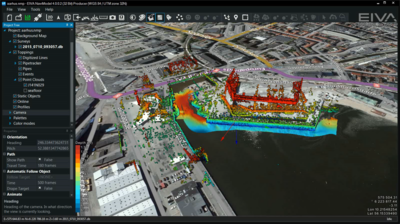
NaviSuite is a collective term for software provided by Eiva, designed to visualize and support various operations performed at sea.
NaviSuite consists of NaviPac for navigation, NaviScan for data acquisition, NaviEdit for data editing, NaviModel for 3D/4D model making, and NaviPlot for chart making. It can be utilized in various scenarios such as marine civil engineering projects related to excavation and barge handling, hydrographical survey for chart making and seabed cable route planning, and marine resource development for wind power facilities construction.
With one license, NaviSuite allows users to perform main operations needed in marine survey from navigation and positioning, data acquisition and editing, 2D/3D model making, to drawing and chart making.
< Reference Videos > *Jump to external URL
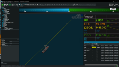
Example of navigation screen
https://www.youtube.com/watch?v=n9CJTvk3Sws
An oil platform and two ROVs(real-time display format)
https://www.youtube.com/watch?v=xJfawXMYO5A
Example of editing data
https://www.youtube.com/watch?v=31Pf0ZAC9pg
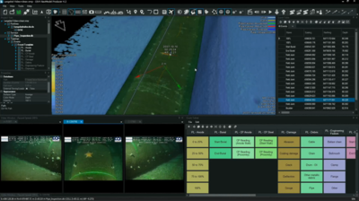
Display in combination with data from camera acquired during pipe inspection
https://www.youtube.com/watch?v=AfJtlveJwDw
Seabed condition profiling
https://www.youtube.com/watch?v=CK3DMiakwow
Product Features
- Good at 3D model making.
- Over 500 devices such as sonars, sensors, and lasers
- Capable of processing large amounts of data without delays.
Product Specifications
| Product Name | NaviSuite |
|---|---|
| Manufacturer Name | EIVA[Manufacturer Website] |
| Product Category | Software |
| Product Details | Download Materials |
Do you want to send the following information?
This is the confirmation page for your entry. If the information is correct, please click the 'Submit' button.
- Entry Page
- Confirmation Page
- Complete


